Ciao Barbara,
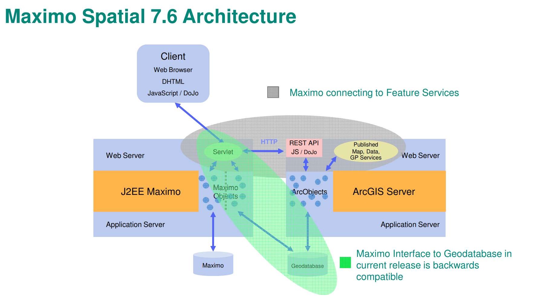
the image below is enough up-to-date to describe the current integration architecture. Basically it relies on the REST APIs exposed by ESRI ArcGIS. Map tiles are downloaded from the browser via HTTP.
PS: in the old Spatial versions, the integration was at the db level; so don't take into account the green area of the image ;-)
------------------------------
Diego Visentin
EAM BU Director
Tempestive S.p.A.
Pordenone
------------------------------
Original Message:
Sent: Tue May 18, 2021 09:02 AM
From: Barbara Guella
Subject: Architecture
Hi,
where may I found an architecture picture of the integration between Maximo Spatial and ESRI?
------------------------------
Barbara Guella
IBM
Rome
------------------------------
#MaximoSpatial
#AssetandFacilitiesManagement
#Maximo